
Rogue Pesticide Stewardship Partnership
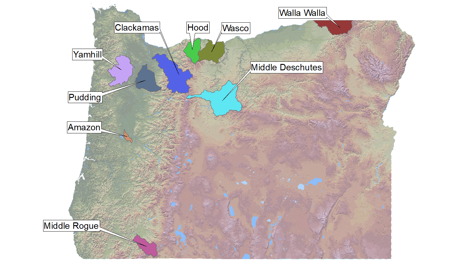
In 2014, Jackson Soil & Water Conservation District and other local partners joined 8 other sites in Oregon to monitor pesticide levels in local surface waters as part of the Pesticide Stewardship Partnership (PSP) Program. This program works to help residents of Oregon understand and reduce the levels of agricultural, commercial, and residential pesticides reaching our state's waterways. The map to the right shows all 9 PSP basins in the state.
Why?
A pesticide, as defined by the Environmental Protection Agency, is any substance, or mixture of substances, intended to prevent, destroy, repel, or mitigate any pest. A pest, while most commonly thought of as an insect, may include fungi, bacteria, rodents, and plants. A pesticide may be used on any of these common pests and may be labeled as a fungicide, rodenticide, insecticide, or herbicide.
While all legally available pesticides have undergone strict regulatory testing for efficacy and safety, it is important to also reduce non-target application and distribution of these chemicals to preserve soil, air, and water quality. In the state of Oregon, our waterways: provide municipal drinking water and agricultural irrigation; are integral habitat to salmon, Pacific lamprey, & steelhead; are economically important recreation centers; and are aesthetic corridors for residents and visitors alike, among other uses. By partnering with state and local agencies to monitor pesticide levels, we can better develop a plan of action to make sure these waters stay clean and healthy for years to come.
Where?
The Rogue Pesticide Stewardship Partnership is the southernmost PSP location in Oregon.
Current sampling watersheds as of 2025:
- Jackson Creek (Central Point)
- Lone Pine Creek (Medford)
- Little Butte Creek (Eagle Point)

What does this mean for you?
Whether you use pesticides to control your backyard weeds or to prevent devestating crop loss, it is important to understand how the chemicals you use interact with the environment. Some chemicals readily break down into less hazardous compounds, while others may persist for years. Our sampling and subsequent testing and analysis by Oregon's Department of Environmental Quality help us to develop a picture of when and where certain chemicals are entering a waterway. The data we collect includes flow, weather, date, and watershed location. All of these factors are important indicators as to why a certain chemical may be detected at a specific time. Did we just see a big rain event after chemical application? Was the water level especially low, thereby increasing concentrations of a chemical on a given day? Which chemicals are applied to which crop?
As our data set grows, we develop outreach and communication plans for specific user groups such as farmers, landscapers, and residential community members. As part of our outreach efforts we provide these user groups with additional information on when and where to use given chemicals, their environmental persistence, and their potential environmental impacts. We aim to use the data we collect to educate and inform the community and reduce the presence of pesticides in our waterways through collaborative efforts. Additionally, we also seek to increase access to information about and knowledge of pesticides and integrated pest management. Visit our integrated pest management page to learn more.
Key Partners in MRPSP:
Southern Oregon Research and Extension Center
Rogue Valley Council of Governments
